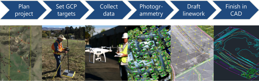
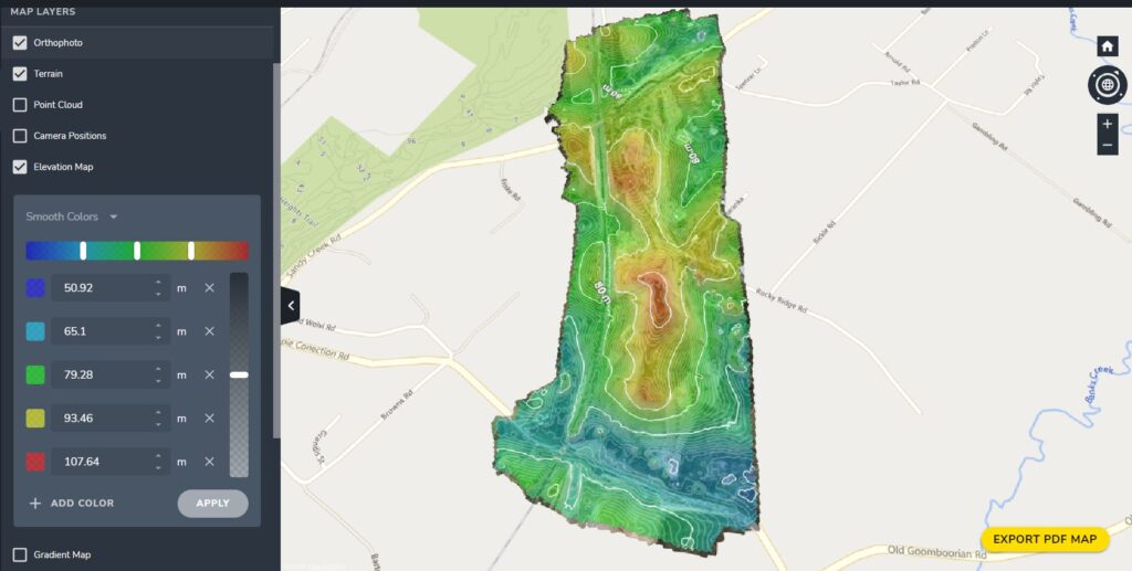
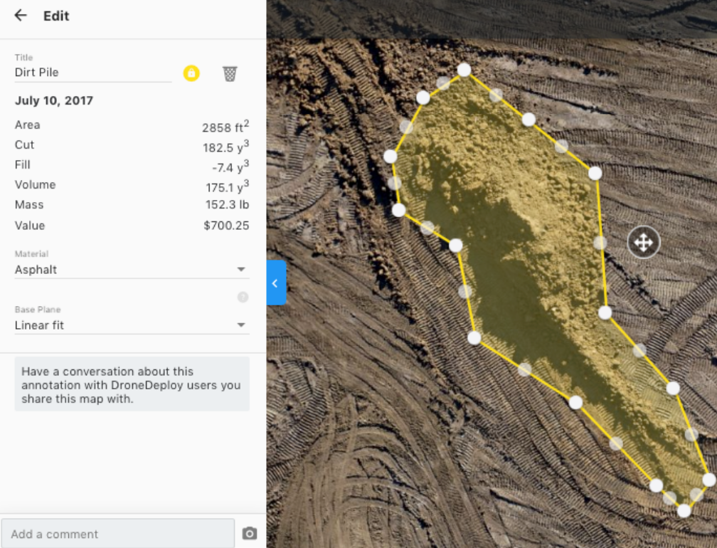
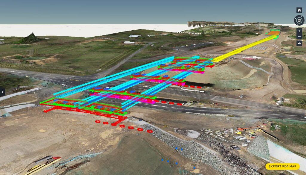
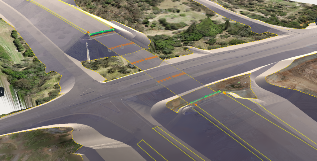
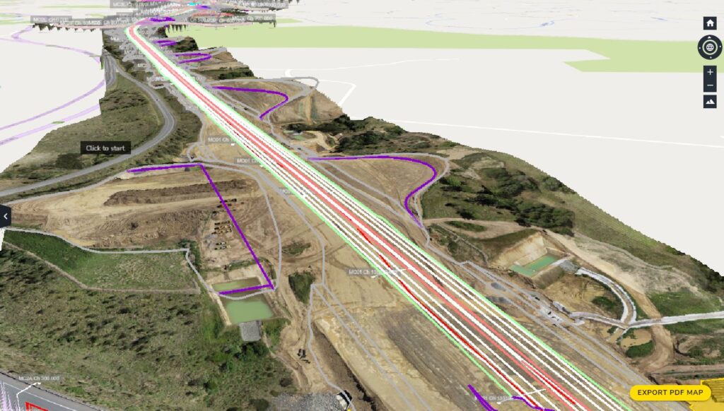
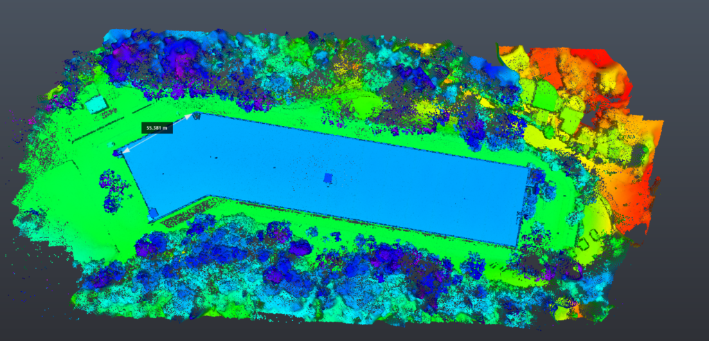
SURVEY & INSPECTION SPECIALIZATIONS 2D Maps Construction progress reports, contractor and area monitoring, Public Utility Plans (PUPs) Traditional GNSS Surveying Conventional pickups, stakeouts and data processing using GNSS equipment 3D Point Cloud & Surface Models Stockpile volume measurements, surface gradient analysis, modelling, bulk earth works high resolution photo and video Detailed photo and video records to assist inspection reports elevation and contour Plots Cross section analysis, earth works claiming and design conformance Data processing, modelling & Reporting Modelling capability in Terramodel, TBC & 12D Drafting capability in Autocad PHOTOGRAMMETRY WORKFLOW dRONE TO LINEWORK PROCESS 01. pHOTOGRAMMETRYPHOTOSGROUND CONTROL POINTSRTK/PPK 02. LINEWORK DRAFTINGORTHOPHOTO DSMPOINT CLOUD 03. CAD FINISHING3D POINTSPOLYLINESDXF FORMAT 04. FINAL DELIVERABLESSURFACE CONTOURSREPORTSDWG FORMAT pROJECT cASE STUDIES Bulk Earth Works - Contour plots, Volumes & Cross section analysis Groote Eylandt Mine Site - stock Pile Analysis Bridge construction (Gympie) - Georeference cAD model overlay Highway updgrade - tIN model overlay highway Upgrade - Main aligment Conformance Greenhill Reservoir - Measurements, Inspection and Volume checks Instagram Youtube Linkedin Facebook We Provide the Best Service in Industry Contact us today for a free quote or enquiries